 Chichontepec Volcano El Salvador
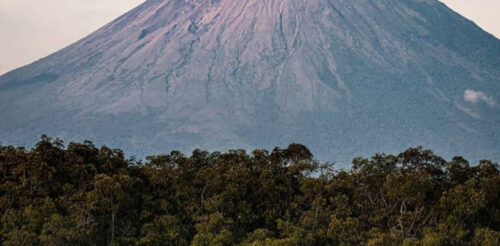
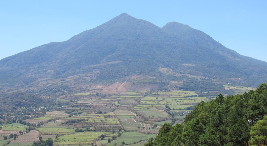
San Vicente Volcano El Salvador, also called Chichontepec Volcano, stands out as one of the country’s most famous natural landmarks. The two peaks rise prominently above the valleys, providing breathtaking views of central El Salvador.
The volcano sits between the departments of San Vicente and La Paz and rises to about 2,182 meters above sea level. Its forests, rough landscape, and volcanic past make it an interesting place to visit.
Although the volcano receives fewer visitors than some of El Salvador’s better-known volcanoes, Chichontepec offers plenty to discover, from scenic mountain landscapes to nearby communities with deep cultural roots.
- San Vicente Volcano Location
- Why It’s Called Chichontepec
- Geological History of Chichontepec
- Hiking San Vicente Volcano
- Natural Beauty and Biodiversity
- Los Infiernillos Geothermal Activity
- San Vicente Volcano Landslides
- Best Time to Visit Chichontepec
- Getting to San Vicente Volcano
- Communities Around Chichontepec
- Is San Vicente Worth Visiting?
San Vicente Volcano: Location and General Information
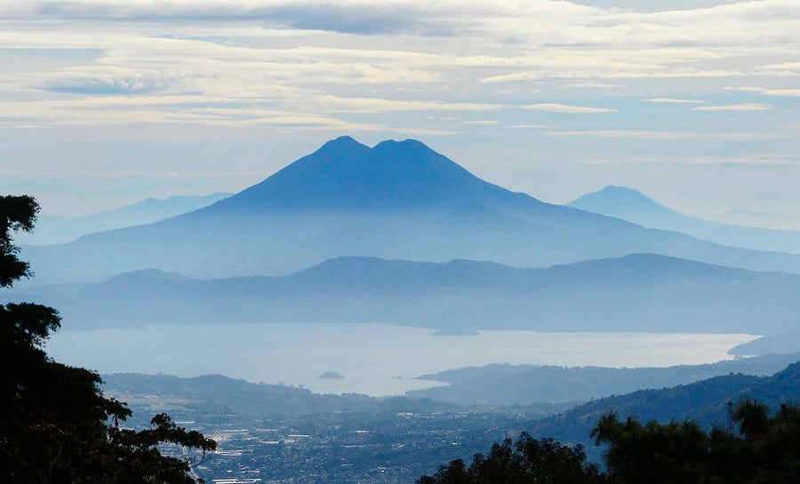
San Vicente Volcano is situated in central El Salvador, southeast of San Salvador and near the city of San Vicente. Its prominent volcanic shape is a striking feature of the landscape and is visible from many nearby towns.
The volcano is part of El Salvador’s volcanic chain, which runs across the country as a section of the Central American Volcanic Arc. This area was shaped by tectonic plate movement over millions of years.
Chichontepec has two main summits, which give it a unique shape. Instead of one cone like many volcanoes, its twin peaks make it easy to recognize in the surrounding countryside.
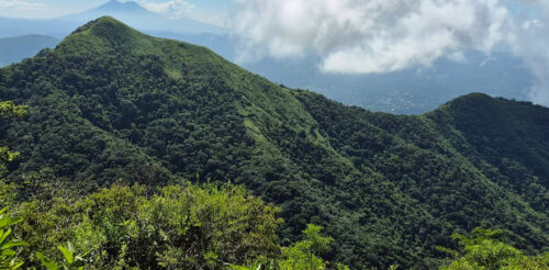
The slopes of the volcano have forests, farmland, and small rural communities.
Why Is San Vicente Volcano Called Chichontepec?
The name Chichontepec comes from Indigenous Nahuat language traditions. People often say it means “Hill of Two Breasts,” which refers to the volcano’s two rounded peaks.
This name shows how much Indigenous cultures have shaped El Salvador’s geography. Many mountains, rivers, and towns in the country still have names from Indigenous languages.
Spanish speakers also call it Volcán de San Vicente because it is close to the city and department of San Vicente. Both names refer to the same volcano. Chichontepec is more than a geographical landmark.
The recognizable peaks are integral to the region’s identity, appearing in daily views, local stories, and cultural references.
The Geological History of Chichontepec Volcano
San Vicente is a stratovolcano, which means it was formed by layers of lava and other volcanic materials building up over time. Its shape grew through volcanic activity over many years.
Although scientists consider Chichontepec a potentially active volcano, there has been no confirmed eruption in recorded history. Still, this does not mean the volcano is completely inactive.
Geothermal features around the mountain demonstrate that heat remains beneath the surface. These features include fumaroles and areas where volcanic gases and steam escape through openings in the ground.
One interesting geothermal spot is Los Infiernillos, where visitors can see steam vents and hot ground. These features give a look at the geological activity under the volcano.
Scientists monitor volcanic systems because conditions can change over time. For visitors, the important thing is to respect restricted areas and follow guidance from local authorities.
Hiking San Vicente Volcano
Hiking Chichontepec lets you discover one of central El Salvador’s most stunning mountain landscapes. To reach the upper slopes, you’ll need to be prepared, physically fit, and familiar with local conditions.
San Vicente is less developed than other volcanic attractions, so it lacks organized tourist facilities. The trails are often steep, overgrown, slippery, or hard to find if you don’t know the area.
Many hikers prefer to hire local guides who are knowledgeable about the area. This is particularly beneficial when exploring new routes or attempting to access the higher regions of the volcano.
What to Expect During the Hike
The scenery changes as you ascend. At lower elevations, you’ll encounter farms and rural areas. As you climb higher, the landscape reveals mountain plants, forests, and rougher terrain.
Some parts of the trail have great views of valleys, nearby towns, and far-off mountains. On clear days, you can really see how big the volcanic landscape is in central El Salvador.
The hike can be challenging, particularly in steep or muddy areas. Factors such as weather, your chosen path, and starting point all influence the difficulty and duration of the hike.
Bring enough water, good hiking shoes, food, and clothes for the weather. A local guide can help you find safe paths and avoid risky areas.
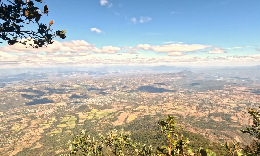
Natural Beauty and Biodiversity Around the Volcano
The slopes of Chichontepec have different natural environments shaped by elevation, temperature, rainfall, and how people use the land. Forested areas are home to birds, insects, reptiles, and other wildlife.
The types of plants on the mountain vary from place to place. Some spots are covered in thick greenery, while others have farmland, secondary forests, or plants that grow well in the cooler air higher up.
Birdwatchers and nature lovers can explore the forested areas that are easy to reach. You don’t have to hike all the way to the top to enjoy the mountain’s views or notice the difference between the farmland and the wild plants.
The volcano also plays an important role in the surrounding environment. Its slopes form part of local watersheds, influencing drainage patterns and the movement of rainwater toward nearby communities.
Los Infiernillos: Geothermal Activity Near Chichontepec
One of the volcano’s most interesting geological features is Los Infiernillos, an area associated with fumaroles, hot ground, and geothermal activity on the volcanic slopes.
Geothermal features form when heat underground meets water and gases. Steam rises through cracks in the ground, shaping a landscape that stands out from the volcano’s greener areas.
This area helps explain why Chichontepec is still important in geology, even though there are no confirmed eruptions in its history. Volcanic activity is not always about visible lava or big explosions.
However, geothermal terrain can be dangerous. Hot surfaces, unstable ground, and volcanic gases pose risks, so visitors should avoid approaching steam vents without qualified local guidance.
The 2009 Landslides on San Vicente Volcano
One of the most significant events in the volcano’s recent history occurred in November 2009, when intense rainfall triggered destructive landslides and debris flows on its slopes.
The disaster hit communities around the volcano hard, especially Verapaz and nearby places. Mud, rocks, and debris rushed down the slopes, damaging homes, roads, and other structures.
This event showed that volcanoes can be dangerous even if they don’t erupt. Heavy rain, steep slopes, and loose ground can lead to serious landslides.
The 2009 disaster is still an important part of the area’s history. It also shows why it’s important to monitor the environment, plan for emergencies, and manage land carefully in mountain areas.
Best Time to Visit San Vicente Volcano
El Salvador generally experiences a dry season from November through April and a rainy season from May through October. These seasonal differences can strongly influence mountain excursions.
Hiking is usually better during the dry season, especially on steep trails that get slippery after it rains. Clear mornings also make it easier to see the surrounding landscape.
During the rainy season, the volcano often appears greener, but cloud cover, muddy paths, and sudden downpours can complicate outdoor activities. Heavy rainfall also increases the risk of landslides.
If you’re planning a hike, check local weather forecasts and trail conditions before traveling. Starting early can help you avoid the strongest afternoon heat and allow more time for the excursion.
How to Get to San Vicente Volcano
San Vicente Volcano is southeast of San Salvador and close to the city of San Vicente. You can get to the area by taking central Salvadoran highways.
The city of San Vicente is a good starting point for exploring the area. From there, getting to the volcano’s trails will depend on your route and current road conditions.
Some routes go through rural communities and farmland. Since trailheads can be difficult to locate, it’s beneficial to arrange transportation and hire a local guide beforehand.
If you’re traveling on your own, make sure you know exactly where you want to start before you leave. Getting close to Chichontepec is not the same as finding a safe and easy way up the mountain.
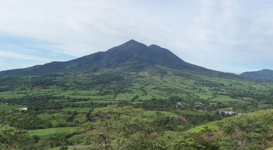
Exploring the Communities Around Chichontepec
The region surrounding San Vicente Volcano offers more than mountain scenery. Small towns, agricultural communities, and traditional Salvadoran landscapes give visitors another perspective on life in central El Salvador.
The city of San Vicente is known for its history and its famous clock tower. You can walk around downtown, try local food, and learn about the area’s culture.
Nearby communities such as Verapaz also have close connections to the volcano. Their history reflects both the opportunities and challenges of living beside a large volcanic mountain.
If you like local culture, spending time in nearby towns as well as hiking the mountain can make your trip more enjoyable than just aiming for the summit.
Is San Vicente Volcano Worth Visiting?
San Vicente Volcano stands out from the more popular volcanic sites in the country. With its twin peaks, geothermal spots, forested hillsides, and nearby communities, this mountain has a unique character.
You don’t have to reach the summit to enjoy Chichontepec. Visiting the nearby communities, taking in its striking shape, and exploring the countryside can be just as memorable.
If you’re ready to go beyond the country’s busiest spots, San Vicente Volcano lets you experience the natural beauty, geological history, and rural charm of central El Salvador.
Chichontepec is only the beginning of what you can discover. From volcanic landscapes to colorful towns and Pacific beaches, explore the best places to visit across El Salvador and start planning your next adventure.