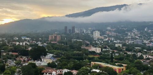
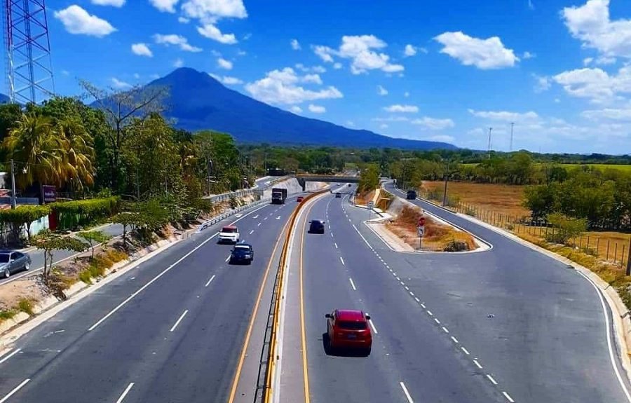
 Highways in El Salvador.
El Salvador is the smallest country in Central America, but a network of highways makes it easy to travel between major cities, farming regions, Pacific beaches, mountain towns, border crossings, and popular destinations.
The country’s small size also makes road trips relatively easy. You can leave San Salvador in the morning and reach a beach, volcano, historic town, or another department within just a few hours.
Several highways form the backbone of this network. The Pan-American Highway, Carretera del Litoral, Troncal del Norte, Carretera Longitudinal del Norte, and other major corridors keep people and goods moving across the country.
Understanding El Salvador’s Highway System
Road names in El Salvador can initially seem confusing. A highway may have an official route designation while Salvadorans commonly identify a particular section by another familiar geographic or local name.
The letters CA mark highways that connect El Salvador with the broader Central American road network. Other roads use national route numbers, but Salvadorans often know major highways and specific sections by their traditional or local names.
Knowing the difference can make navigating El Salvador much easier. For example, locals may call this stretch of highway Los Chorros instead of CA-1, even though it’s part of the Pan-American Highway west of San Salvador.
Pan-American Highway (CA-1)
The Pan-American Highway, or CA-1, is arguably El Salvador’s most important highway. It crosses much of the country from west to east and connects major population and commercial centers.
In western El Salvador, the highway takes drivers toward Santa Ana and the Guatemalan border. As it moves into central El Salvador, it passes through the busy corridor around Santa Tecla and San Salvador.
One of its best-known sections is Los Chorros, between the San Salvador metropolitan area and western El Salvador. The mountainous terrain surrounding this section has historically made landslides and slope stability important infrastructure concerns.
From the capital, CA-1 heads east through San Martín and passes near Cojutepeque before continuing across the country. Follow the highway farther east, and you’ll eventually reach San Miguel, the largest and most important city in eastern El Salvador.
The highway also plays an international role. Freight trucks, buses, commuters, and private vehicles use the Pan-American corridor as part of the transportation network connecting El Salvador with Guatemala and Honduras.
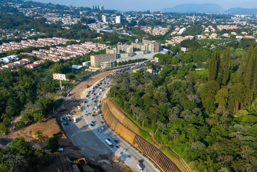
Carretera del Litoral (CA-2)
If CA-1 serves as El Salvador’s principal inland east-west corridor, CA-2, commonly called the Carretera del Litoral, provides another major route across the country closer to the Pacific coast.
Travelers use this corridor to reach numerous coastal destinations and communities. The highway also provides an important transportation link for agriculture, tourism, local commerce, and freight moving through southern El Salvador.
In western El Salvador, CA-2 takes you toward the La Hachadura border crossing with Guatemala. Along the way, the coastal highway connects communities and destinations across Ahuachapán, Sonsonate, La Libertad, and other parts of the Pacific coast.
Continuing east takes motorists through or near communities across La Paz, Usulután, San Miguel, and La Unión. For visitors exploring the coast, CA-2 can become one of their most frequently traveled highways.
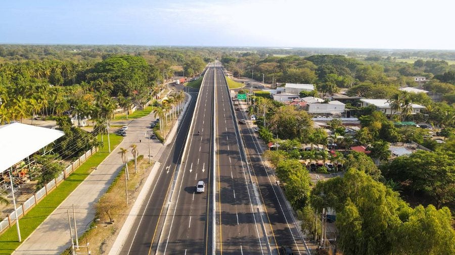
Troncal del Norte (CA-4N)
The Troncal del Norte, designated CA-4N, links the San Salvador metropolitan region with northern El Salvador. It passes through the Apopa area before continuing toward communities in Chalatenango.
This isn’t simply a passenger route. Agricultural products grown in northern El Salvador move along the corridor toward markets around Greater San Salvador, making the highway important to the country’s food distribution network.
Continue north and the highway eventually reaches El Poy, one of El Salvador’s land border crossings with Honduras. That international connection also gives the Troncal del Norte considerable commercial and logistical importance.
Carretera Longitudinal del Norte
The Carretera Longitudinal del Norte transformed transportation across a region that historically had weaker road connections than central and coastal El Salvador. Construction began in 2007 and concluded in 2012.
The highway stretches about 242 kilometers across northern El Salvador. FOMILENIO I made the project a major priority, aiming to create economic opportunities and improve transportation between communities throughout the region.
Rather than funneling every journey toward San Salvador, the highway created stronger east-west connections between northern communities. It serves areas associated with Chalatenango, Cabañas, northern San Miguel, and other parts of the region.
These connections make a big difference for Sensuntepeque and nearby communities. Farmers, businesses, residents, and travelers can move more easily across northern El Salvador without depending on older routes through the central part of the country.
Carretera al Puerto de La Libertad (CA-4S)
The Carretera al Puerto de La Libertad, or CA-4S, is one of the most important routes for travelers leaving the San Salvador metropolitan area and heading toward the Pacific coast.
The highway heads south from Santa Tecla through La Libertad toward the Pacific coast. Along the way, drivers can connect to Nuevo Cuscatlán, Zaragoza, and several nearby residential communities.
For tourism, the route has an obvious role. Many visitors heading from San Salvador toward La Libertad’s beaches, restaurants, surf destinations, and coastal attractions use this corridor during their trip.
Autopista a Comalapa
International visitors often experience the Autopista a Comalapa before many other Salvadoran highways. It provides the primary road connection between the San Salvador metropolitan area and the country’s main international airport.
The route travels south from the capital region through San Marcos and toward La Paz. Drivers can continue toward the airport or connect with other roads serving the country’s coastal region.
Because the airport sits outside San Salvador, this highway carries tourists, Salvadorans returning from abroad, commercial vehicles, taxis, buses, and airport transfers throughout the week. Holiday periods can make the corridor particularly busy.
Carretera de Oro
The Carretera de Oro serves a different purpose from the country’s long-distance highways. It functions as an important metropolitan and regional connector around the northern and eastern sides of Greater San Salvador.
The corridor helps connect areas around Apopa, Soyapango, and neighboring communities while providing links between other major roads. That makes it particularly useful for commuters and vehicles trying to navigate the metropolitan road network.
Its strategic importance becomes clearer when looking at the wider system. Road projects around Apopa, for example, are designed to improve connections between Carretera de Oro and the Troncal del Norte.
Driving on El Salvador’s Main Highways
Distances in El Salvador may look short on a map, but don’t let that fool you. Traffic around Greater San Salvador, roadwork, accidents, and bad weather can easily turn a short drive into a much longer trip.
The country’s mountainous landscape can also make driving challenging. Highways like the Pan-American cross areas prone to landslides, while heavy rains can bring falling rocks, flooding, damaged roads, and temporary closures.
You should also expect driving conditions to change quickly between regions. A modern multilane highway near San Salvador can eventually narrow into a two-lane road as the route moves through less populated areas.
Highways Connect More Than Cities
El Salvador’s highways do more than connect San Salvador with other cities. They help farmers get their products to markets, take workers to their jobs, move exports across borders, and connect communities with essential services.
They also make exploring the country easier. From the capital, you can head west toward Santa Ana, south toward Pacific beaches, north toward Chalatenango, or east toward San Miguel and La Unión.
For travelers, learning the main highways provides a better understanding of how El Salvador fits together. For Salvadorans, these roads remain part of everyday life, carrying everything from morning commuters to international cargo.